
Ovingdean topographic map
Interactive map
Click on the map to display elevation.
About this map
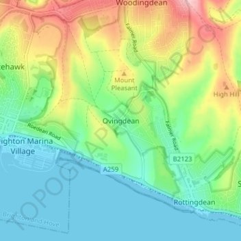
Name: Ovingdean topographic map, elevation, terrain.
Location: Ovingdean, Brighton and Hove, England, BN2 7BB, United Kingdom (50.79690 -0.09653 50.83690 -0.05653)
Average elevation: 58 m
Minimum elevation: -1 m
Maximum elevation: 179 m
Brighton and Hove trails, hiking, mountain biking, running and outdoor activities
Other topographic maps
Click on a map to view its topography, its elevation and its terrain.