
Botanischer Garten topographic map
Interactive map
Click on the map to display elevation.
About this map
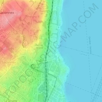
Name: Botanischer Garten topographic map, elevation, terrain.
Location: Botanischer Garten, Pâquis, Genf, Schweiz (46.22351 6.14467 46.22874 6.14861)
Average elevation: 401 m
Minimum elevation: 368 m
Maximum elevation: 471 m
Other topographic maps
Click on a map to view its topography, its elevation and its terrain.