
Beeston topographic map
Click on the map to display elevation.
About this map
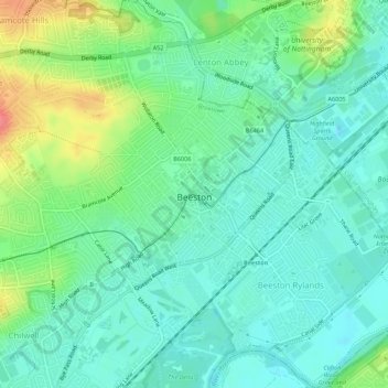
Name: Beeston topographic map, elevation, terrain.
Average elevation: 39 m
Minimum elevation: 19 m
Maximum elevation: 85 m
Nottinghamshire trails, hiking, mountain biking, running and outdoor activities
Other topographic maps
Click on a map to view its topography, its elevation and its terrain.
Manor House Pond
United Kingdom > England > Nottinghamshire > Broxtowe > Bramcote
Average elevation: 57 m
Nottingham Canal Local Nature Reserve
United Kingdom > England > Nottinghamshire > Broxtowe
Average elevation: 66 m
Attenborough Nature Reserve
United Kingdom > England > Nottinghamshire > Broxtowe > Beeston
Average elevation: 34 m