
Bakewell topographic map
Click on the map to display elevation.
About this map
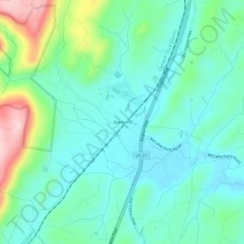
Name: Bakewell topographic map, elevation, terrain.
Average elevation: 269 m
Minimum elevation: 204 m
Maximum elevation: 468 m
Other topographic maps
Click on a map to view its topography, its elevation and its terrain.
Chattanooga
United States > Tennessee > Hamilton County
Chattanooga showcases a diverse and striking topography that is defined by its position within the Appalachian region. Nestled between the rugged Ridge-and-Valley Appalachians and the Cumberland Plateau, the city is framed by dramatic hills and valleys, creating a visually compelling landscape. The Tennessee…
Average elevation: 331 m
Chattanooga
United States > Tennessee > Hamilton County
According to the United States Census Bureau, the city has a total area of 144.6 square miles (374.4 km2), of which 137.1 square miles (355.2 km2) are land and 7.4 square miles (19.2 km2), or 5.12%, are water. The most prominent natural features in and around Chattanooga are the Tennessee River and the…
Average elevation: 331 m
Chattanooga
United States > Tennessee > Hamilton County
With a downtown elevation of about 680 feet (210 m), Chattanooga is at the transition between the ridge-and-valley portion of the Appalachian Mountains and the Cumberland Plateau. Its official nickname is "Scenic City", alluding to the surrounding by mountains and ridges. Unofficial nicknames include "River…
Average elevation: 331 m
Chattanooga
United States > Tennessee > Hamilton County
The city, with a downtown elevation of about 680 feet (210 m), is at the transition between the ridge-and-valley portion of the Appalachian Mountains and the Cumberland Plateau. Its official nickname is "Scenic City", alluding to the surrounding by mountains and ridges. Unofficial nicknames include "River…
Average elevation: 331 m