
Mobara topographic map
Interactive map
Click on the map to display elevation.
About this map
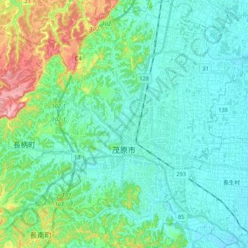
Name: Mobara topographic map, elevation, terrain.
Location: Mobara, Chiba Prefecture, Japan (35.37940 140.24445 35.50282 140.38136)
Average elevation: 29 m
Minimum elevation: 1 m
Maximum elevation: 133 m
Mobara is located in an inland area of north-central Bōsō Peninsula, about 25 kilometers from the prefectural capital at Chiba and 50 to 60 kilometers from the center of Tokyo. Most of the city is the Kujukuri Plain, and the mountains in the western part of the city are formed by the Bōsō Hill Range. The elevation of the city is about 8 to 9 meters above sea level in the lowlands of the southeast, about 11 meters in the city, and 20 to 100 meters in the west, with a maximum of 117.7 meters. In some areas, land subsidence due to human factors such as pumping of surface groundwater and natural gas brackish water has become a problem, and subsidence of up to about 10 cm has been observed.