
Oas topographic map
Click on the map to display elevation.
About this map
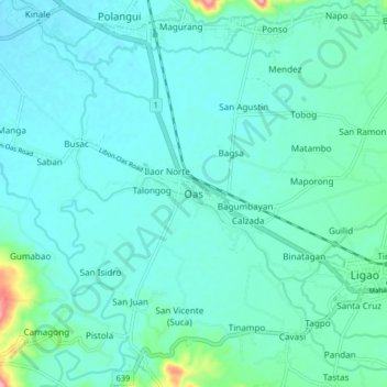
Name: Oas topographic map, elevation, terrain.
Location: Oas, Albay, Bicol Region, 4505, Philippines (13.21704 123.46017 13.29704 123.54017)
Average elevation: 39 m
Minimum elevation: 17 m
Maximum elevation: 173 m
Other topographic maps
Click on a map to view its topography, its elevation and its terrain.
Polangui
known during the early times that the barrio has vas and fertile agricultural land, and because of this, settlers from nearby places migrated to this barrio to venture in agricultural farming. One of the early settlers who migrated to this barrio came from barrio La Medalla, town of Iriga (now a City) of the…
Average elevation: 193 m
Daraga
67.3% of the total municipal land area has a predominantly low elevation of up to 100 metres (330 ft). The surface terrain is generally characterized by combination of level to nearly level areas, gentle to undulating areas and undulating to rolling areas.
Average elevation: 124 m