
Hurricane topographic map
Interactive map
Click on the map to display elevation.
About this map
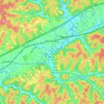
Name: Hurricane topographic map, elevation, terrain.
Average elevation: 237 m
Minimum elevation: 184 m
Maximum elevation: 324 m
Other topographic maps
Click on a map to view its topography, its elevation and its terrain.
Liberty
United States > West Virginia > Putnam County
Liberty, Putnam County, West Virginia, 25124, United States
Average elevation: 281 m