Geolocate

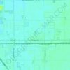
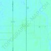
Finkle topographic map

Click on the map to display elevation.

About this map

Name: Finkle topographic map, elevation, terrain.

Location: Finkle, Clay County, Minnesota, 56560, United States (46.79385 -96.76730 46.83385 -96.72730)

Average elevation: 278 m

Minimum elevation: 274 m

Maximum elevation: 282 m

Other topographic maps

Click on a map to view its topography, its elevation and its terrain.

Georgetown

United States > Minnesota > Clay County

Average elevation: 269 m

Dilworth

United States > Minnesota > Clay County

Average elevation: 278 m

Moorhead

United States > Minnesota > Clay County

Average elevation: 277 m

Barnesville

United States > Minnesota > Clay County

Average elevation: 311 m

Glyndon

United States > Minnesota > Clay County

Average elevation: 282 m

Felton

United States > Minnesota > Clay County

Average elevation: 279 m

Felton

United States > Minnesota > Clay County

Average elevation: 279 m

Hawley

United States > Minnesota > Clay County

Average elevation: 356 m

Comstock

United States > Minnesota > Clay County

Average elevation: 281 m

Gear up for your next adventure:

💧Hydration Reservoirs - Convenient water bladders for hands-free drinking on the move
⌚GPS Outdoor Watches - Watches with GPS tracking for hiking and exploration
📦Compression Sacks - Reduce backpack volume efficiently
🧗Locking Carabiners - Secure gear to your pack or for light technical use
🥾Trekking Poles - Poles to improve stability on uneven terrain

As an Amazon Associate, this site earns from qualifying purchases at no extra cost to you.