Geolocate

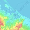
Greerton topographic map

Click on the map to display elevation.

About this map

Name: Greerton topographic map, elevation, terrain.

Location: Greerton, Tauranga City, Bay of Plenty, 3112, New Zealand (-37.76070 176.11090 -37.70368 176.16107)

Average elevation: 29 m

Minimum elevation: -1 m

Maximum elevation: 137 m

Other topographic maps

Click on a map to view its topography, its elevation and its terrain.
Tauranga

New Zealand > Bay of Plenty > Tauranga City

Average elevation: 66 m

Mangatawa

New Zealand > Bay of Plenty > Tauranga City > Papamoa

Average elevation: 18 m

Tauranga

New Zealand > Bay of Plenty > Tauranga City

Average elevation: 63 m

Greerton

New Zealand > Bay of Plenty > Tauranga City

Average elevation: 31 m

Tauranga

New Zealand > Bay of Plenty > Tauranga City

Average elevation: 66 m

Tauranga

New Zealand > Bay of Plenty > Tauranga City

Average elevation: 66 m

Tauranga

New Zealand > Bay of Plenty > Tauranga City

Average elevation: 66 m

Tauranga

New Zealand > Bay of Plenty > Tauranga City

Average elevation: 66 m

Gear up for your next adventure:

🧭Professional Hiking Compasses - High-precision liquid-filled compasses for map reading and orientation
🌦️Portable Weather Meters - Handheld tools for monitoring weather conditions
📱Rugged Phone Cases - Heavy-duty protection for smartphones used as secondary GPS tools
🗺️Ordnance Survey Maps - Official UK maps for walking and outdoor activities
🛌Sleeping Mats - Insulated mats for comfortable outdoor sleeping

As an Amazon Associate, this site earns from qualifying purchases at no extra cost to you.