
Kasungu National Park topographic map
Interactive map
Click on the map to display elevation.
About this map
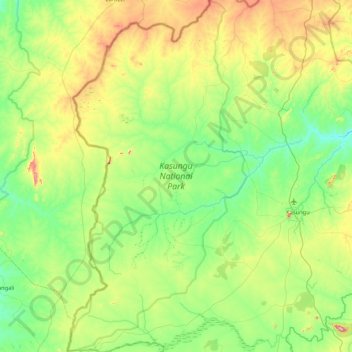
Name: Kasungu National Park topographic map, elevation, terrain.
Average elevation: 1,087 m
Minimum elevation: 940 m
Maximum elevation: 1,499 m
Kasungu National Park, established in 1970, is the second-largest in Malawi at 2,316 square kilometres (894 sq mi), with an elevation of approximately 1,000 metres (3,300 ft) above sea level on average. It is located in the Central Region approximately 165 km (103 mi) north of Lilongwe.
Other topographic maps
Click on a map to view its topography, its elevation and its terrain.