Geolocate

Sille topographic map

Interactive map

Click on the map to display elevation.

About this map

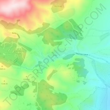
Name: Sille topographic map, elevation, terrain.

Location: Sille, Selçuklu, Konya, Central Anatolia Region, Turkey (37.90821 32.39847 37.94821 32.43847)

Average elevation: 1,264 m

Minimum elevation: 1,083 m

Maximum elevation: 1,580 m

Other topographic maps

Click on a map to view its topography, its elevation and its terrain.

Sızma

Turkey > Selçuklu

Sızma, Selçuklu, Konya, Central Anatolia Region, Turkey

Average elevation: 1,528 m

Konya

Turkey > Selçuklu

Konya, Selçuklu, Konya, Central Anatolia Region, 42200, Turkey

Average elevation: 1,160 m