
Thank you for supporting this site ❤️
Make a donation
Make a donation
Gear up for your next adventure:
As an Amazon Associate, this site earns from qualifying purchases at no extra cost to you.
Narhisar topographic map
Click on the map to display elevation.
Thank you for supporting this site ❤️
Make a donation
Make a donation
Gear up for your next adventure:
As an Amazon Associate, this site earns from qualifying purchases at no extra cost to you.
About this map
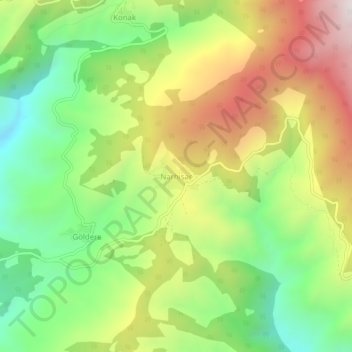
Name: Narhisar topographic map, elevation, terrain.
Location: Narhisar, Milas, Muğla, Aegean Region, Turkey (37.42567 27.68242 37.46567 27.72242)
Average elevation: 579 m
Minimum elevation: 156 m
Maximum elevation: 1,125 m
Thank you for supporting this site ❤️
Make a donation
Make a donation
Gear up for your next adventure:
As an Amazon Associate, this site earns from qualifying purchases at no extra cost to you.