
İstinye Mahallesi topographic map
Interactive map
Click on the map to display elevation.
About this map
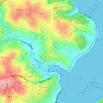
Name: İstinye Mahallesi topographic map, elevation, terrain.
Location: İstinye Mahallesi, Sarıyer, Istanbul, Marmara Region, Turkey (41.11024 29.03714 41.12728 29.06227)
Average elevation: 46 m
Minimum elevation: 0 m
Maximum elevation: 134 m
Other topographic maps
Click on a map to view its topography, its elevation and its terrain.