
Muara Bungo topographic map
Interactive map
Click on the map to display elevation.
About this map
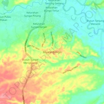
Name: Muara Bungo topographic map, elevation, terrain.
Location: Muara Bungo, Bungo, Jambi, Sumatra, 37211, Indonesia (-1.55615 102.07874 -1.47615 102.15874)
Average elevation: 73 m
Minimum elevation: 38 m
Maximum elevation: 130 m
Other topographic maps
Click on a map to view its topography, its elevation and its terrain.