Geolocate

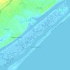
Ashton topographic map

Click on the map to display elevation.

About this map

Name: Ashton topographic map, elevation, terrain.

Location: Ashton, Pender County, North Carolina, United States (34.45544 -77.92110 34.49544 -77.88110)

Average elevation: 16 m

Minimum elevation: 4 m

Maximum elevation: 23 m

Other topographic maps

Click on a map to view its topography, its elevation and its terrain.
Burgaw

United States > North Carolina > Pender County

Average elevation: 14 m

Watha

United States > North Carolina > Pender County

Average elevation: 17 m

Atkinson

United States > North Carolina > Pender County

Average elevation: 19 m

Burgaw

United States > North Carolina > Pender County

Average elevation: 14 m

Gear up for your next adventure:

🎒Replacement Sternum Straps - Repair parts for hiking rucksacks
🧥Waterproof Hiking Jackets - Rain protection for walking in all weather conditions
🛌Insulated Sleeping Mats - Crucial thermal protection when sleeping on cold, uneven ground
🥾Walking Shoes - Lightweight walking shoes for countryside and coastal paths
🧣Neck Gaiters - Versatile protection against wind and cold

As an Amazon Associate, this site earns from qualifying purchases at no extra cost to you.