
Sondu topographic map
Interactive map
Click on the map to display elevation.
About this map
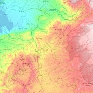
Name: Sondu topographic map, elevation, terrain.
Location: Sondu, Kericho County, Rift Valley, Kenya (-0.60871 34.76291 -0.31234 35.52284)
Average elevation: 1,760 m
Minimum elevation: 1,132 m
Maximum elevation: 2,585 m
Other topographic maps
Click on a map to view its topography, its elevation and its terrain.