
หนองป่าครั่ง topographic map
Interactive map
Click on the map to display elevation.
About this map
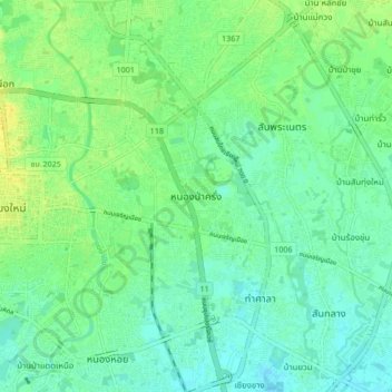
Name: หนองป่าครั่ง topographic map, elevation, terrain.
Location: หนองป่าครั่ง, ต้นเปา, อำเภอสารภี, Chiang Mai, 55520, Thailand (18.75049 98.98673 18.83049 99.06673)
Average elevation: 307 m
Minimum elevation: 299 m
Maximum elevation: 319 m
Other topographic maps
Click on a map to view its topography, its elevation and its terrain.