
Las Anod District topographic map
Interactive map
Click on the map to display elevation.
About this map
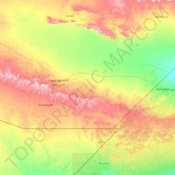
Name: Las Anod District topographic map, elevation, terrain.
Location: Las Anod District, Sool, Somalia (7.99983 46.91963 8.84224 48.73000)
Average elevation: 631 m
Minimum elevation: 417 m
Maximum elevation: 1,047 m
Other topographic maps
Click on a map to view its topography, its elevation and its terrain.
Las Anod
Somalia > Sool > Las Anod District
Las Anod, Las Anod District, Sool, Somalia
Average elevation: 731 m