
Sơn Lý topographic map
Interactive map
Click on the map to display elevation.
About this map
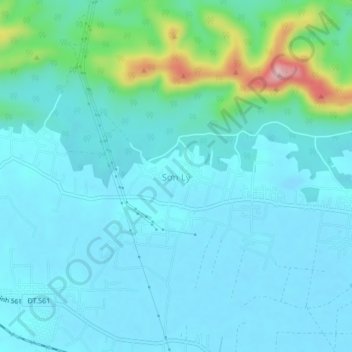
Name: Sơn Lý topographic map, elevation, terrain.
Location: Sơn Lý, Bố Trạch District, Quang Binh province, Vietnam (17.62033 106.44774 17.66033 106.48774)
Average elevation: 34 m
Minimum elevation: -9 m
Maximum elevation: 223 m
Other topographic maps
Click on a map to view its topography, its elevation and its terrain.
Phong Nha Town
Vietnam > Quang Binh province > Bố Trạch District
Phong Nha Town, Bố Trạch District, Quảng Bình Province, Vietnam
Average elevation: 66 m