
Usakos topographic map
Interactive map
Click on the map to display elevation.
About this map
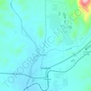
Name: Usakos topographic map, elevation, terrain.
Location: Usakos, Erongo Region, Namibia (-22.00943 15.57991 -21.96987 15.59988)
Average elevation: 890 m
Minimum elevation: 851 m
Maximum elevation: 1,150 m
Other topographic maps
Click on a map to view its topography, its elevation and its terrain.
Gobabeb Research & Training
Namibia > Erongo Region > Gobabeb Research & Training
Gobabeb Research & Training, Erongo Region, Namibia
Average elevation: 410 m