
Smithville topographic map
Interactive map
Click on the map to display elevation.
About this map
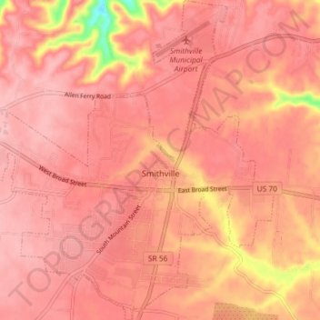
Name: Smithville topographic map, elevation, terrain.
Location: Smithville, DeKalb County, Tennessee, United States (35.93352 -85.85626 35.99254 -85.78829)
Average elevation: 317 m
Minimum elevation: 212 m
Maximum elevation: 345 m
Other topographic maps
Click on a map to view its topography, its elevation and its terrain.
Temperance Hall
United States > Tennessee > DeKalb County
Temperance Hall, DeKalb County, Tennessee, 38569, United States
Average elevation: 203 m