
All Cannings topographic map
Interactive map
Click on the map to display elevation.
About this map
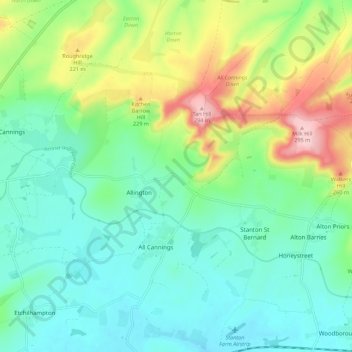
Name: All Cannings topographic map, elevation, terrain.
Location: All Cannings, Wiltshire, England, United Kingdom (51.33430 -1.92260 51.40350 -1.83968)
Average elevation: 161 m
Minimum elevation: 105 m
Maximum elevation: 296 m
Wiltshire trails, hiking, mountain biking, running and outdoor activities
Other topographic maps
Click on a map to view its topography, its elevation and its terrain.