
Lukum Khola topographic map
Interactive map
Click on the map to display elevation.
About this map
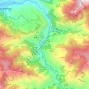
Name: Lukum Khola topographic map, elevation, terrain.
Location: Lukum Khola, Bhume-04, Bhume, Eastern Rukum, Nepal (28.56898 82.61999 28.63143 82.64600)
Average elevation: 1,835 m
Minimum elevation: 1,094 m
Maximum elevation: 2,808 m
Other topographic maps
Click on a map to view its topography, its elevation and its terrain.