
Stone County topographic map
Interactive map
Click on the map to display elevation.
About this map
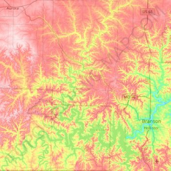
Name: Stone County topographic map, elevation, terrain.
Location: Stone County, Missouri, United States (36.49841 -93.61313 36.99577 -93.30431)
Average elevation: 354 m
Minimum elevation: 212 m
Maximum elevation: 483 m
Other topographic maps
Click on a map to view its topography, its elevation and its terrain.
Little Lost Creek Conservation Area
United States > Missouri > Warren County > Pendleton
Average elevation: 241 m
Richard L. Berkley Riverfront Park
United States > Missouri > Jackson County > Kansas City
Average elevation: 242 m
Mississippi & Missouri River Confluence Point
United States > Missouri > Saint Charles County > West Alton
Average elevation: 126 m