
Mount Gay topographic map
Interactive map
Click on the map to display elevation.
About this map
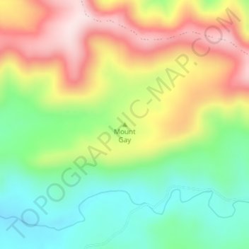
Name: Mount Gay topographic map, elevation, terrain.
Location: Mount Gay, Southern Downs Regional, Queensland, Australia (-28.11672 152.23328 -28.11662 152.23338)
Average elevation: 738 m
Minimum elevation: 579 m
Maximum elevation: 938 m
Other topographic maps
Click on a map to view its topography, its elevation and its terrain.
Mount Coot-tha
It is often claimed that Mount Coot-tha is the "highest point in Brisbane", but, as the elevations above show, the peak known as Mount Coot-tha is not even the highest peak of the mountain as a whole with both Constitution Hill and The Summit being higher. However, Mount Coot-tha has a lookout with unobscured…
Average elevation: 88 m
Alexandra Hills
Scribbly Gums Conservation Area is located on the eastern edge of Alexandra Hills, bordered by Redland Hospital to the east, and Flinders St and Winchester Rd to the north. The conservation area occupies approximately 152 hectares and contains the Redlands Track Park - a collection of 30+ mountain bike trails…
Average elevation: 34 m
Top Camp
Australia > Queensland > Toowoomba
Top Camp is 9 kilometres (6 mi) from the Toowoomba city centre via the New England Highway. It is immediately to the west of the Great Dividing Range and is at an elevation of 580 to 630 metres (1,900 to 2,070 ft).The highway passes through the eastern part of the locality from north (Kearney Springs) to south…
Average elevation: 604 m