
Airedale topographic map
Interactive map
Click on the map to display elevation.
Airedale
This valley is of great topographic significance as it provides low-altitude passes through the mid Pennines to the west coast known as the Aire Gap.
About this map
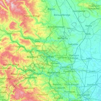
Name: Airedale topographic map, elevation, terrain.
Average elevation: 58 m
Minimum elevation: 0 m
Maximum elevation: 372 m
East Riding of Yorkshire trails, hiking, mountain biking, running and outdoor activities
Other topographic maps
Click on a map to view its topography, its elevation and its terrain.
Little Driffield
United Kingdom > England > East Riding of Yorkshire > Driffield
Average elevation: 30 m
Stamford Bridge
United Kingdom > England > East Riding of Yorkshire > Stamford Bridge
Average elevation: 16 m