
Hampton topographic map
Interactive map
Click on the map to display elevation.
About this map
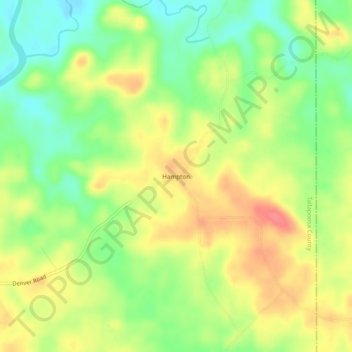
Name: Hampton topographic map, elevation, terrain.
Location: Hampton, Tallapoosa County, Alabama, United States (32.93874 -85.63190 32.97874 -85.59190)
Average elevation: 202 m
Minimum elevation: 170 m
Maximum elevation: 235 m
Other topographic maps
Click on a map to view its topography, its elevation and its terrain.
Horseshoe Bend National Military Park
United States > Alabama > Tallapoosa County
Average elevation: 186 m
Camp Hill
United States > Alabama > Tallapoosa County > Camp Hill > Camp Hill
Average elevation: 203 m