Geolocate

Exeter topographic maps

Click on a map to view its topography, its elevation and its terrain.
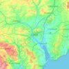
Exeter

United Kingdom > England > Devon > Exeter

The city of Exeter was established on the eastern bank of the River Exe on a ridge of land backed by a steep hill. It is at this point that the Exe, having just been joined by the River Creedy, opens onto a wide flood plain and estuary which results in quite common flooding. Historically this was the lowest…

Average elevation: 99 m
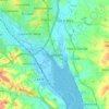
Topsham

United Kingdom > England > Devon > Exeter

Average elevation: 25 m

Whitestone Cross

United Kingdom > England > Devon > Exeter

Average elevation: 70 m

Pilton

United Kingdom > England > Devon > Exeter

Average elevation: 45 m

Clyst Heath

United Kingdom > England > Devon > Exeter > Topsham

Average elevation: 26 m

About this place

Gear up for your next adventure:

📱Phone Mounts for Hiking - Secure mounts to carry your phone on trails
🧷Tenacious Repair Tape - Instant fix for torn tents, jackets, or dry bags
📚UK Hiking Guidebooks - Detailed route descriptions for the Lake District, Peaks, and Highlands
🔋Solar Power Banks - Keep your GPS and phone charged during multi-day expeditions
👖Hiking Trousers - Durable trousers designed for rough terrain

As an Amazon Associate, this site earns from qualifying purchases at no extra cost to you.