Geolocate

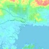
Lahad Datu topographic maps

Click on a map to view its topography, its elevation and its terrain.

Lahad Datu

Malaysia > Sabah > Lahad Datu

Average elevation: 17 m

Gunung Silam

Malaysia > Sabah > Lahad Datu

Average elevation: 539 m

Gunung Bagahak

Malaysia > Sabah > Lahad Datu

Average elevation: 557 m

Bandar Kembara Sakti

Malaysia > Sabah > Lahad Datu

Average elevation: 14 m

Sakar Island

Malaysia > Sabah > Lahad Datu > Lahad Datu

Average elevation: 8 m

About this place

Gear up for your next adventure:

🥤Collapsible Water Bottles - Save space in your rucksack as you consume your water
🎿Telescopic Trekking Poles - Reduces knee strain on steep topographic descents
🔪Outdoor Multi-Tools - Versatile tools for gear repairs and food prep in the wild
⛺Lightweight Tents - Compact tents for backpacking and trekking
🌦️Portable Weather Meters - Handheld tools for monitoring weather conditions

As an Amazon Associate, this site earns from qualifying purchases at no extra cost to you.