
Sfântu Gheorghe topographic map
Interactive map
Click on the map to display elevation.
About this map
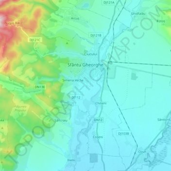
Name: Sfântu Gheorghe topographic map, elevation, terrain.
Location: Sfântu Gheorghe, Covasna, Romania (45.79723 25.67484 45.90311 25.85861)
Average elevation: 581 m
Minimum elevation: 503 m
Maximum elevation: 999 m
Other topographic maps
Click on a map to view its topography, its elevation and its terrain.
Sfântu Gheorghe
Romania > Covasna > Sfântu Gheorghe
Sfântu Gheorghe, Covasna, Romania
Average elevation: 551 m