
Naraha topographic map
Interactive map
Click on the map to display elevation.
About this map
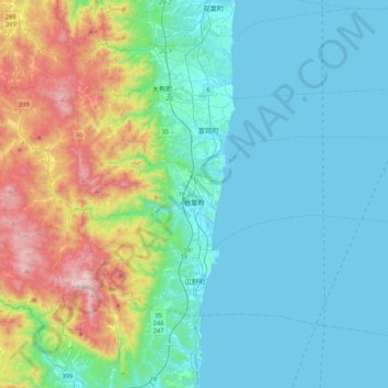
Name: Naraha topographic map, elevation, terrain.
Location: Naraha, Futaba County, Fukushima Prefecture, Japan (37.23911 140.86703 37.33954 141.28920)
Average elevation: 183 m
Minimum elevation: 0 m
Maximum elevation: 848 m
Other topographic maps
Click on a map to view its topography, its elevation and its terrain.
Kawauchi
Kawauchi is located in the Abukuma Plateau of central Fukushima with a mean altitude of between 400 and 500 meters. North of Kawauchi, there is at 37°22′53″N 140°48′16″E / 37.38139°N 140.80444°E / 37.38139; 140.80444 (Kawauchi Substation) a substation of Kita–Iwaki powerline, a 500…
Average elevation: 574 m