Geolocate

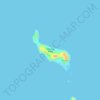
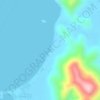
Araceli topographic map

Click on the map to display elevation.

About this map

Name: Araceli topographic map, elevation, terrain.

Location: Araceli, Palawan, Mimaropa, 5311, Philippines (10.35448 119.75036 10.85647 120.46727)

Average elevation: 2 m

Minimum elevation: 0 m

Maximum elevation: 280 m

Other topographic maps

Click on a map to view its topography, its elevation and its terrain.
Brooke's Point

Philippines > Palawan

Average elevation: 5 m

Pamalican Island

Philippines > Palawan > Cuyo > Manamoc

Average elevation: 1 m

Amanpulo

Philippines > Palawan > Cuyo

Average elevation: 0 m

Camanga Island

Philippines > Palawan > Coron

Average elevation: 1 m

Punang

Philippines > Palawan

Average elevation: 31 m

Pinaglabanan

Philippines > Palawan

Average elevation: 86 m

Sand Cay

Philippines > Palawan > Balabac

Average elevation: 3 m

Quezon

Philippines > Palawan

Average elevation: 38 m

Darab Island

Philippines > Palawan > Culion

Average elevation: 26 m

Kalayaan

Philippines > Palawan > Kalayaan

The islets that comprise the municipality are generally flat. The highest ground elevation is approximately two meters above sea level.

Average elevation: 0 m

Sarong

Philippines > Palawan

Average elevation: 21 m

Iwahig

Philippines > Palawan

Average elevation: 17 m

Mangenguey Island

Philippines > Palawan > Busuanga

Average elevation: 1 m

Mangroves

Philippines > Palawan > Coron > Borac

Average elevation: 45 m

Nacpan Beach

Philippines > Palawan > El Nido > Calitang

Average elevation: 36 m

Gear up for your next adventure:

🧣Neck Gaiters - Versatile protection against wind and cold
🦶Anti-Blister Balms - Protect your feet before long topographic expeditions
🧼Biodegradable Soap - Leave-no-trace hygiene for multi-day mountain treks
📸Action Camera Chest Mounts - Record your ascent following topographic paths hands-free
🥾Trekking Poles - Poles to improve stability on uneven terrain

As an Amazon Associate, this site earns from qualifying purchases at no extra cost to you.