
سبيطلة topographic map
Interactive map
Click on the map to display elevation.
About this map
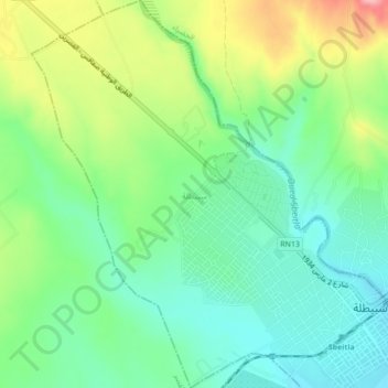
Name: سبيطلة topographic map, elevation, terrain.
Location: سبيطلة, معتمدية سبيطلة, Kasserine, 1250, Tunisia (35.22299 9.09339 35.25842 9.13320)
Average elevation: 562 m
Minimum elevation: 512 m
Maximum elevation: 659 m
Other topographic maps
Click on a map to view its topography, its elevation and its terrain.