
Hnausapollur topographic map
Interactive map
Click on the map to display elevation.
About this map
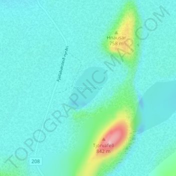
Name: Hnausapollur topographic map, elevation, terrain.
Location: Hnausapollur, Rangárþing ytra, Southern Region, Iceland (64.04848 -19.03895 64.05505 -19.02491)
Average elevation: 608 m
Minimum elevation: 575 m
Maximum elevation: 814 m
Other topographic maps
Click on a map to view its topography, its elevation and its terrain.