Geolocate

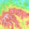
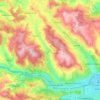
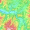
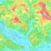
Bucea topographic map

Click on the map to display elevation.

About this map

Name: Bucea topographic map, elevation, terrain.

Location: Bucea, Negreni, Cluj, 407441, Romania (46.92913 22.67481 46.96913 22.71481)

Average elevation: 505 m

Minimum elevation: 355 m

Maximum elevation: 752 m

Other topographic maps

Click on a map to view its topography, its elevation and its terrain.

Cluj-Napoca

Romania > Cluj

A wide variety of flora grow in the Cluj-Napoca Botanical Garden; some animals have also found refuge there. The city has a number of other parks, of which the largest is the Central Park. This park was founded during the 19th century and includes an artificial lake with an island, as well as the largest…

Average elevation: 480 m

Aghireșu

Romania > Cluj

Average elevation: 495 m

Gilău

Romania > Cluj

Average elevation: 566 m

Florești

Romania > Cluj

Average elevation: 485 m

Cluj-Napoca

Romania > Cluj

A wide variety of flora grow in the Cluj-Napoca Botanical Garden; some animals have also found refuge there. The city has a number of other parks, of which the largest is the Central Park. This park was founded during the 19th century and includes an artificial lake with an island, as well as the largest…

Average elevation: 480 m

Cojocna

Romania > Cluj

Average elevation: 403 m

Bonțida

Romania > Cluj

Average elevation: 351 m

Câmpia Turzii

Romania > Cluj

Average elevation: 313 m

Gârbău

Romania > Cluj

Average elevation: 501 m

Feleacu

Romania > Cluj

Average elevation: 588 m

Turda

Romania > Cluj

Average elevation: 393 m

Sic

Romania > Cluj

Average elevation: 366 m

Cluj-Napoca

Romania > Cluj

A wide variety of flora grow in the Cluj-Napoca Botanical Garden; some animals have also found refuge there. The city has a number of other parks, of which the largest is the Central Park. This park was founded during the 19th century and includes an artificial lake with an island, as well as the largest…

Average elevation: 480 m

Gherla

Romania > Cluj > Gherla > Gherla

Average elevation: 280 m

Dej

Romania > Cluj

Average elevation: 329 m

Cluj-Napoca

Romania > Cluj

A wide variety of flora grow in the Cluj-Napoca Botanical Garden; some animals have also found refuge there. The city has a number of other parks, of which the largest is the Central Park. This park was founded during the 19th century and includes an artificial lake with an island, as well as the largest…

Average elevation: 480 m

Apahida

Romania > Cluj

Average elevation: 384 m

Florești

Romania > Cluj

Average elevation: 485 m

Turda

Romania > Cluj

Average elevation: 393 m

Beliș

Romania > Cluj

Average elevation: 1,225 m

Chinteni

Romania > Cluj

Average elevation: 469 m

Dezmir

Romania > Cluj

Average elevation: 374 m

Măguri-Răcătău

Romania > Cluj

Average elevation: 1,227 m

Mărișel

Romania > Cluj

Average elevation: 1,101 m

Mihai Viteazu

Romania > Cluj

Average elevation: 397 m

Suatu

Romania > Cluj

Average elevation: 410 m

Baciu

Romania > Cluj

Average elevation: 496 m

Negreni

Romania > Cluj

Average elevation: 619 m

Călățele

Romania > Cluj

Average elevation: 876 m

Cheile Baciului

Romania > Cluj > Baciu

Average elevation: 432 m

Barajul Tarnița

Romania > Cluj > Gilău

Average elevation: 626 m

Poieni

Romania > Cluj

Average elevation: 761 m

Cătina

Romania > Cluj

Average elevation: 380 m

Huedin

Romania > Cluj

Average elevation: 511 m

Ciucea

Romania > Cluj

Average elevation: 620 m

Mihai Viteazu

Romania > Cluj

Average elevation: 397 m

Stephen the Great Park

Romania > Cluj > Cluj-Napoca

Average elevation: 364 m

Mărgău

Romania > Cluj

Average elevation: 989 m

Măguri-Răcătău

Romania > Cluj

Average elevation: 1,227 m

Săvădisla

Romania > Cluj

Average elevation: 633 m

Muntele Băișorii

Romania > Cluj

Average elevation: 1,115 m

Cluj-Napoca

Romania > Cluj

A wide variety of flora grow in the Cluj-Napoca Botanical Garden; some animals have also found refuge there. The city has a number of other parks, of which the largest is the Central Park. This park was founded during the 19th century and includes an artificial lake with an island, as well as the largest…

Average elevation: 480 m

Cășeiu

Romania > Cluj

Average elevation: 386 m

Someșul Cald River

Romania > Cluj

Average elevation: 1,014 m

Băișoara

Romania > Cluj

Average elevation: 738 m

Cheia

Romania > Cluj

Average elevation: 384 m

Gear up for your next adventure:

🖼️Topographic Map Art - Decorative 3D-effect posters of famous UK peaks and regions
💧Hydration Reservoirs - Convenient water bladders for hands-free drinking on the move
🧢Waterproof Hiking Hats - Keep the rain off your face while studying topographic maps
☕Insulated Travel Mugs - Keep drinks hot while surveying the landscape from a summit
📻Hand-Crank Emergency Radios - Stay updated on weather warnings in remote areas

As an Amazon Associate, this site earns from qualifying purchases at no extra cost to you.