
Ang Thong topographic map
Interactive map
Click on the map to display elevation.
About this map
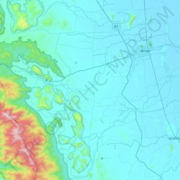
Name: Ang Thong topographic map, elevation, terrain.
Location: Ang Thong, Phatthalung Province, Thailand (7.38782 99.82158 7.70782 100.14158)
Average elevation: 132 m
Minimum elevation: -1 m
Maximum elevation: 1,306 m
Other topographic maps
Click on a map to view its topography, its elevation and its terrain.