
Carthage topographic map
Click on the map to display elevation.
Carthage
The elevation of the land at the promontory on the seashore to the north-east (now called Sidi Bou Saïd), was twice as high above sea level as that at the Byrsa (100 m and 50 m). In between runs a ridge, several times reaching 50 m; it continues northwestward along the seashore, and forms the edge of a plateau-like area between the Byrsa and the sea. Newer urban developments lay here in these northern districts.
About this map
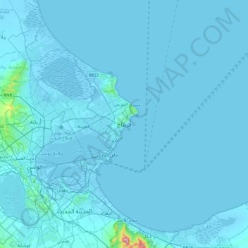
Name: Carthage topographic map, elevation, terrain.
Location: Carthage, Tunis, 2016, Tunisia (36.69481 10.17099 37.01481 10.49099)
Average elevation: 9 m
Minimum elevation: -7 m
Maximum elevation: 540 m
Other topographic maps
Click on a map to view its topography, its elevation and its terrain.
Tunis
The city of Tunis is built on a hill slope down to the lake of Tunis. These hills contain places such as Notre-Dame de Tunis, Ras Tabia, La Rabta, La Kasbah, Montfleury, and La Manoubia with altitudes just above 50 metres (160 feet). The city is located at the crossroads of a narrow strip of land between Lake…
Average elevation: 37 m
Medina of Tunis
In the case of domestic architecture, the more a building is set back from the shops, the more it is valued. The concept of withdrawal and privacy is paramount. The late introduction of a sewer system means that much waste water still flows through the streets of the Medina. The largest houses and noble places…
Average elevation: 16 m
Tunis
The city of Tunis is built on a hill slope down to the lake of Tunis. These hills contain places such as Notre-Dame de Tunis, Ras Tabia, La Rabta, La Kasbah, Montfleury, and La Manoubia with altitudes just above 50 metres (160 feet). The city is located at the crossroads of a narrow strip of land between Lake…
Average elevation: 37 m