Geolocate

Zuidplas topographic map

Click on the map to display elevation.

Zuidplas

Dutch Topographic map of the municipality of Zuidplas, September 2014

Wikipedia (CC-BY-SA 3.0)

About this map

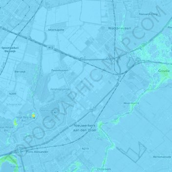
Name: Zuidplas topographic map, elevation, terrain.

Location: Zuidplas, South Holland, Netherlands (51.93349 4.54634 52.06554 4.68868)

Average elevation: -3 m

Minimum elevation: -8 m

Maximum elevation: 21 m

Other topographic maps

Click on a map to view its topography, its elevation and its terrain.

Langeraar

Netherlands > South Holland

Average elevation: -3 m

Broekhuizen

Netherlands > South Holland > Gouda

Average elevation: -1 m

Ankerpark

Netherlands > South Holland > Leiden

Average elevation: 3 m

Middelsluis

Netherlands > South Holland > Numansdorp

Average elevation: 0 m

Meije

Netherlands > South Holland > Nieuwkoop

Average elevation: -2 m

Weerestein

Netherlands > South Holland > Hillegom

Average elevation: 0 m

Weerestein

Netherlands > South Holland > Hillegom

Average elevation: 0 m

Botlek

Netherlands > South Holland

Average elevation: 3 m

Meijendel

Netherlands > South Holland > Wassenaar

Average elevation: 6 m

Coepelduynen

Netherlands > South Holland > Katwijk

Average elevation: 4 m

Het Park

Netherlands > South Holland > Rotterdam

Average elevation: 4 m

Waalhaven

Netherlands > South Holland > Rotterdam

Average elevation: 3 m

Gear up for your next adventure:

🪢Paracord - Multi-purpose cord for camping and survival
🔦Outdoor Torches - Reliable torches for night navigation
🧭GPS Trackers - Tracking devices for safety and navigation
❄️Walking Crampons - Added traction for icy slopes and winter peak bagging
🧤Waterproof Overmitts - Extreme weather protection for hikers and mountaineers

As an Amazon Associate, this site earns from qualifying purchases at no extra cost to you.