
Lake Mburo-Nakivali Wetland topographic map
Interactive map
Click on the map to display elevation.
About this map
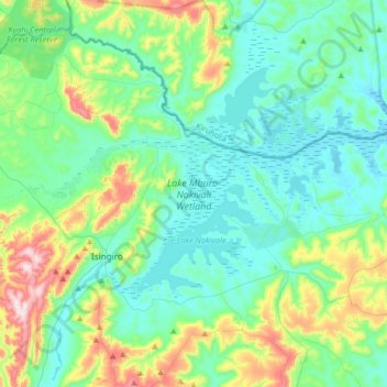
Name: Lake Mburo-Nakivali Wetland topographic map, elevation, terrain.
Location: Lake Mburo-Nakivali Wetland, Isingiro, Western Region, Uganda (-0.83258 30.82348 -0.65305 31.15287)
Average elevation: 1,355 m
Minimum elevation: 1,235 m
Maximum elevation: 1,778 m
Other topographic maps
Click on a map to view its topography, its elevation and its terrain.