
Savusavu topographic map
Interactive map
Click on the map to display elevation.
About this map
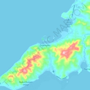
Name: Savusavu topographic map, elevation, terrain.
Location: Savusavu, Cakaudrove, Northern, Fiji (-16.82022 179.29290 -16.74022 179.37290)
Average elevation: 28 m
Minimum elevation: -2 m
Maximum elevation: 242 m
Other topographic maps
Click on a map to view its topography, its elevation and its terrain.