
淇滨区 topographic map
Interactive map
Click on the map to display elevation.
About this map
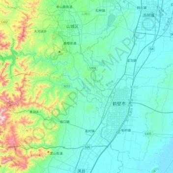
Name: 淇滨区 topographic map, elevation, terrain.
Location: 淇滨区, 鹤壁市, 河南省, 458000, 中国 (35.64140 114.00046 35.91966 114.40402)
Average elevation: 201 m
Minimum elevation: 57 m
Maximum elevation: 891 m
Other topographic maps
Click on a map to view its topography, its elevation and its terrain.