
牛横岭村 topographic map
Interactive map
Click on the map to display elevation.
About this map
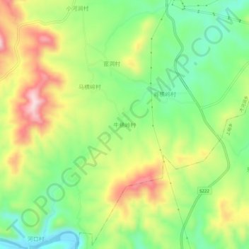
Name: 牛横岭村 topographic map, elevation, terrain.
Location: 牛横岭村, 鹤壁市, 河南省, 中国 (35.84131 114.08643 35.88131 114.12643)
Average elevation: 299 m
Minimum elevation: 167 m
Maximum elevation: 476 m
Other topographic maps
Click on a map to view its topography, its elevation and its terrain.