
Berdan topographic map
Interactive map
Click on the map to display elevation.
About this map
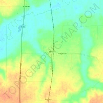
Name: Berdan topographic map, elevation, terrain.
Location: Berdan, Greene County, Illinois, United States (39.34505 -90.41540 39.38505 -90.37540)
Average elevation: 153 m
Minimum elevation: 135 m
Maximum elevation: 174 m
Other topographic maps
Click on a map to view its topography, its elevation and its terrain.