
els Guiamets topographic map
Interactive map
Click on the map to display elevation.
About this map
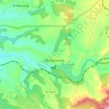
Name: els Guiamets topographic map, elevation, terrain.
Location: els Guiamets, Priorat, Tarragone, Catalogne, 43777, Espagne (41.08454 0.71107 41.12326 0.77507)
Average elevation: 205 m
Minimum elevation: 88 m
Maximum elevation: 449 m
Other topographic maps
Click on a map to view its topography, its elevation and its terrain.
Pradell de la Teixeta
Pradell de la Teixeta, Priorat, Tarragone, Catalogne, 43774, Espagne
Average elevation: 491 m
la Torre de Fontaubella
la Torre de Fontaubella, Priorat, Tarragone, Catalogne, 43774, Espagne
Average elevation: 516 m