
Langa topographic map
Interactive map
Click on the map to display elevation.
About this map
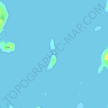
Name: Langa topographic map, elevation, terrain.
Location: Langa, Schotland, VK (60.13371 -1.33127 60.14159 -1.32641)
Average elevation: 0 m
Minimum elevation: -11 m
Maximum elevation: 26 m
Other topographic maps
Click on a map to view its topography, its elevation and its terrain.
Fort William
VK > Schotland > Fort William
Fort William, Highland, Schotland, PH33 6DH, VK
Average elevation: 122 m
Forth and Clyde Canal
Forth and Clyde Canal, East Dunbartonshire, Schotland, G81 1QA, VK
Average elevation: 130 m
Caledonian Canal
Caledonian Canal, Highland, Schotland, IV3 8RE, VK
Average elevation: 420 m
Linga
VK > Schotland > South Garth
Linga, South Garth, Shetland Islands, Schotland, VK
Average elevation: 7 m
Greenbraehead
VK > Schotland > Greenbraehead
Greenbraehead, Scottish Borders, Schotland, TD9 9SW, VK
Average elevation: 187 m