Geolocate

Bako National Park topographic map

Click on the map to display elevation.

About this map

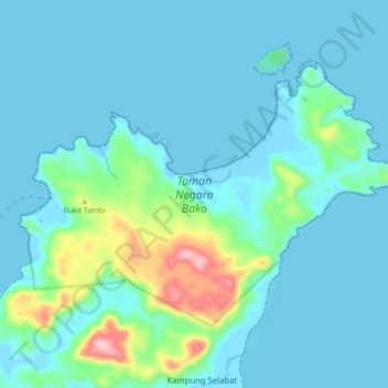
Name: Bako National Park topographic map, elevation, terrain.

Location: Bako National Park, Kampung Selabat, Kuching, Kuching Division, Sarawak, Malaysia (1.69124 110.43920 1.75028 110.52591)

Average elevation: 40 m

Minimum elevation: -3 m

Maximum elevation: 280 m

Gear up for your next adventure:

🧭Orienteering Compasses - Accurate compasses for map-based navigation
🧢Waterproof Hiking Hats - Keep the rain off your face while studying topographic maps
👕Merino Base Layers - Natural temperature regulation for cold weather hiking and camping
🧼Technical Clothing Wash - Special soap to clean and restore waterproof membranes
🛌Sleeping Mats - Insulated mats for comfortable outdoor sleeping

As an Amazon Associate, this site earns from qualifying purchases at no extra cost to you.