Geolocate

Hasfield topographic map

Click on the map to display elevation.

About this map

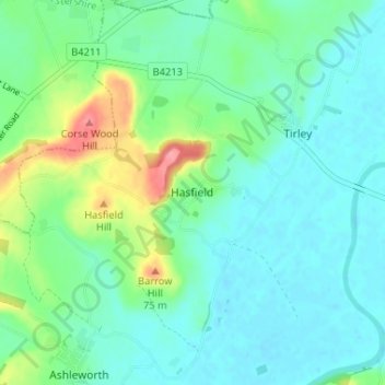
Name: Hasfield topographic map, elevation, terrain.

Location: Hasfield, Tewkesbury, Gloucestershire, England, GL19 4LG, United Kingdom (51.92849 -2.27475 51.96849 -2.23475)

Average elevation: 27 m

Minimum elevation: 6 m

Maximum elevation: 92 m

Gloucestershire trails, hiking, mountain biking, running and outdoor activities

Other topographic maps

Click on a map to view its topography, its elevation and its terrain.

Twyning

United Kingdom > England > Gloucestershire > Tewkesbury

Average elevation: 22 m

Snowshill

United Kingdom > England > Gloucestershire > Tewkesbury

Average elevation: 249 m

Hawling

United Kingdom > England > Gloucestershire > Tewkesbury

Average elevation: 241 m

Stanway

United Kingdom > England > Gloucestershire > Tewkesbury > Stanway

Average elevation: 170 m

Norton

United Kingdom > England > Gloucestershire > Tewkesbury

Average elevation: 18 m

Gretton

United Kingdom > England > Gloucestershire > Tewkesbury

Average elevation: 100 m

Snowshill

United Kingdom > England > Gloucestershire > Tewkesbury

Average elevation: 249 m

Northway

United Kingdom > England > Gloucestershire > Tewkesbury

Average elevation: 21 m

Twyning

United Kingdom > England > Gloucestershire > Tewkesbury

Average elevation: 22 m

Hasfield

United Kingdom > England > Gloucestershire > Tewkesbury

Average elevation: 21 m

Gear up for your next adventure:

📷Outdoor Action Cameras - Cameras designed for hiking and adventure
🥾Trekking Poles - Poles to improve stability on uneven terrain
🔦Head Torches - Hands-free lighting for hiking and camping
Altimeter Watches - Watches measuring altitude for mountain activities
🎒Hiking Backpacks - Comfortable backpacks for day hikes and multi-day treks

As an Amazon Associate, this site earns from qualifying purchases at no extra cost to you.