Kikandwa topographic map
Interactive map
Click on the map to display elevation.
About this map
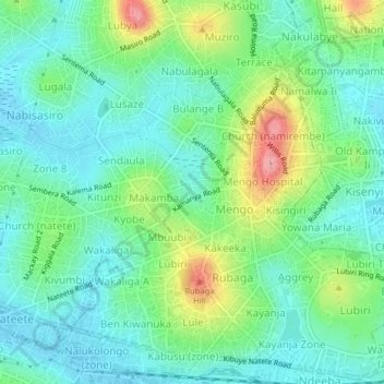
Name: Kikandwa topographic map, elevation, terrain.
Location: Kikandwa, Kampala, Central Region, Uganda (0.29188 32.53126 0.33188 32.57126)
Average elevation: 1,191 m
Minimum elevation: 1,157 m
Maximum elevation: 1,275 m
Other topographic maps
Click on a map to view its topography, its elevation and its terrain.
Isreal-matovu
Uganda > Central Region > Kampala
Isreal-matovu, Kampala, Central Region, Uganda
Average elevation: 1,187 m
Bahai
Uganda > Central Region > Kampala
Bahai, Kawempe, Kampala, Central Region, Uganda
Average elevation: 1,200 m
Kawempe
Uganda > Central Region > Kampala
Kawempe, Kampala, Central Region, Uganda
Average elevation: 1,196 m
Rubaga
Uganda > Central Region > Kampala
Rubaga, Kampala, Central Region, Uganda
Average elevation: 1,187 m
Central
Uganda > Central Region > Kampala
Central, Kampala, Central Region, Uganda
Average elevation: 1,193 m