
Zalambessa topographic map
Interactive map
Click on the map to display elevation.
About this map
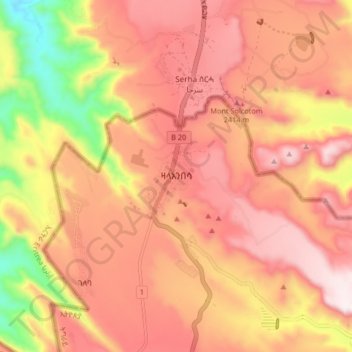
Name: Zalambessa topographic map, elevation, terrain.
Location: Zalambessa, Eastern Tigray, Tigray, Ethiopia (14.48564 39.34710 14.56564 39.42710)
Average elevation: 2,289 m
Minimum elevation: 1,875 m
Maximum elevation: 2,530 m
Other topographic maps
Click on a map to view its topography, its elevation and its terrain.
Mek'elē
Mekelle (Tigrinya: መቐለ), or Mekele, is a special zone and capital of the Tigray Region of Ethiopia. Mekelle was formerly the capital of Enderta awraja in Tigray. It is located around 780 kilometres (480 mi) north of the Ethiopian capital Addis Ababa, with an elevation of 2,254 metres (7,395 ft) above sea…
Average elevation: 2,090 m
Sheraro
Sheraro (Tigrinya: ሸራሮ) is a town and separate woreda in Tigray, Ethiopia. It is located in the North Western Zone of the Tigray Region, at an elevation of 1246 meters above sea level. It is the administrative center of Tahtay Adiyabo. It is near the border with Eritrea.
Average elevation: 1,041 m
Abiy Addi
Abiy Addi has an elevation ranging from 1917 to 2275 meters above sea level. From the higher to the lower locations, the following geological formations are present: Ashangi Basalts, Amba Aradam Formation, Adigrat Sandstone, and Edaga Arbi Glacials.
Average elevation: 1,957 m
Humera
Humera (Tigrinya: ሑመራ; Amharic: ሁመራ) is a town in the Kafta Humera woreda in the Tigray Region of Ethiopia. Located in the Western Zone the town has an elevation of 585 metres (1,919 ft) above sea level. The Tekezé river borders the town to the north. Humera is a very important regional…
Average elevation: 594 m
Adigrat
Adigrat (Tigrinya: ዓዲግራት, ʿaddigrat, also called ʿAddi Grat) is a city and separate woreda in Tigray Region of Ethiopia. It is located in the Misraqawi Zone at longitude and latitude 14°16′N 39°27′E / 14.267°N 39.450°E / 14.267; 39.450Coordinates: 14°16′N 39°27′E /…
Average elevation: 2,557 m