Geolocate

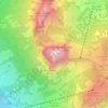
Stoos topographic map

Click on the map to display elevation.

About this map

Name: Stoos topographic map, elevation, terrain.

Location: Stoos, Morschach, Schwyz, 6433, Switzerland (46.95736 8.64664 46.99736 8.68664)

Average elevation: 1,232 m

Minimum elevation: 465 m

Maximum elevation: 1,921 m

Other topographic maps

Click on a map to view its topography, its elevation and its terrain.

Riemenstalden

Switzerland > Schwyz > Schwyz

Average elevation: 1,457 m

Sattel

Switzerland > Schwyz > Schwyz

Average elevation: 989 m

Oberiberg

Switzerland > Schwyz > Schwyz

Average elevation: 1,369 m

Unteriberg

Switzerland > Schwyz > Schwyz

Average elevation: 1,346 m

Mythen

Switzerland > Schwyz > Schwyz > Schwyz

Average elevation: 1,219 m

Arth

Switzerland > Schwyz > Schwyz

Average elevation: 865 m

Arth

Switzerland > Schwyz > Schwyz > Arth

Average elevation: 865 m

Ingenbohl

Switzerland > Schwyz > Schwyz

Average elevation: 674 m

Gear up for your next adventure:

📦Compression Sacks - Reduce backpack volume efficiently
🔦Head Torches - Hands-free lighting for hiking and camping
🌄Compact Monoculars - Lightweight optics for hiking
🧊Personal Water Filters - Drink safely from mountain streams marked on your map
👖Convertible Hiking Trousers - Versatile zip-off pants for changing mountain weather conditions

As an Amazon Associate, this site earns from qualifying purchases at no extra cost to you.